
Release of version 1.2 – Guidelines for Planning in Bushfire Prone Areas
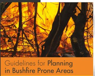
The Guidelines for Planning in Bushfire Prone Areas have been updated.
The changes are outlined in the summary table at the front of the guidelines and include:
• Clearer definitions provided on what constitutes a vulnerable land use and the information required to be provided in an emergency evacuation plan.
• Appendix Two – Bushfire Hazard Level assessment amended to include an updated assessment methodology.
• Appendix three – BAL Contour Map amended to include an updated assessment methodology.
Bushfire Prone Planning Staff are available to assist with your questions regarding the application of the Updated Guidelines for Planning in Bushfire Prone Areas. We also welcome general enquiries regarding a Bushfire Attack Level (BAL) assessment for your next big project or an in depth Bushfire Management Plan (BMP) for a land development application. Our knowledgeable staff can be contacted on (6477 1144) or through the “Contact Us” section of our Website.
- May 2025
- April 2025
- February 2025
- November 2024
- October 2024
- September 2024
- August 2024
- May 2024
- April 2024
- August 2023
- July 2023
- April 2023
- May 2022
- February 2022
- November 2021
- March 2021
- February 2021
- January 2021
- November 2020
- October 2020
- August 2020
- June 2020
- April 2020
- March 2020
- February 2020
- November 2019
- August 2019
- March 2019
- January 2019
- November 2018
- October 2018
- May 2018
- March 2018
- February 2018
- November 2017
- October 2017
- September 2017
- August 2017
- June 2017
- April 2017
- March 2017
- February 2017
- January 2017
- December 2016
- November 2016
- August 2016
- July 2016
- May 2016
- April 2016
- March 2016
- February 2016
- January 2016
- December 2015
CATEGORIES
ARCHIVES
- May 2025
- April 2025
- February 2025
- November 2024
- October 2024
- September 2024
- August 2024
- May 2024
- April 2024
- August 2023
- July 2023
- April 2023
- May 2022
- February 2022
- November 2021
- March 2021
- February 2021
- January 2021
- November 2020
- October 2020
- August 2020
- June 2020
- April 2020
- March 2020
- February 2020
- November 2019
- August 2019
- March 2019
- January 2019
- November 2018
- October 2018
- May 2018
- March 2018
- February 2018
- November 2017
- October 2017
- September 2017
- August 2017
- June 2017
- April 2017
- March 2017
- February 2017
- January 2017
- December 2016
- November 2016
- August 2016
- July 2016
- May 2016
- April 2016
- March 2016
- February 2016
- January 2016
- December 2015
Service Areas


 |