
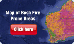
Bushfire Prone Area Map
In December 2015, the DFES Commissioner published the Map of Bush Fire Prone Areas.
This map identifies land falling within, or partially within, a bush fire prone area of Western Australia as designated by the Fire and Emergency Services (FES) Commissioner.
If a property sits within a designated bushfire prone area, based on the WA Map of Bush Fire Prone Areas or from local council mapping, then you may have additional bushfire planning and building requirements.
Service Areas


 |